UNEDITED TRANSCRIPT: Larry Zoom Oct 9 (with timestamps)
But anyway, welcome everybody.
And we're getting going here in October, a tad early, but never too early to get a little psyched about some snow in the mountains. And it will be coming, but not tomorrow or the next couple of days. We'll sort that out in a few minutes.
But this is the Northwest ski season snow forecast. For year 2024 to 2025, that is this upcoming winter, of course. And things have changed since last winter.
(0:45 - 0:59)
We're looking at a situation that is not going to be like we saw last year, which was El Niño. This is La Niña this year. La Niña means good powder for the Northwest and a much better weather pattern.
(0:59 - 1:30)
So welcome, everyone. And this is brought to you by the Grand Puba Powder. And Andrea is my faithful assistant.
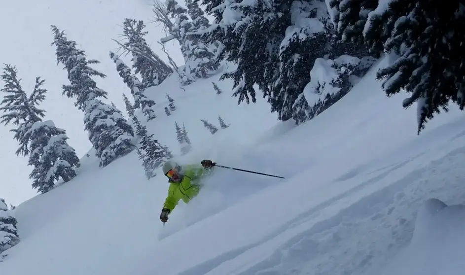
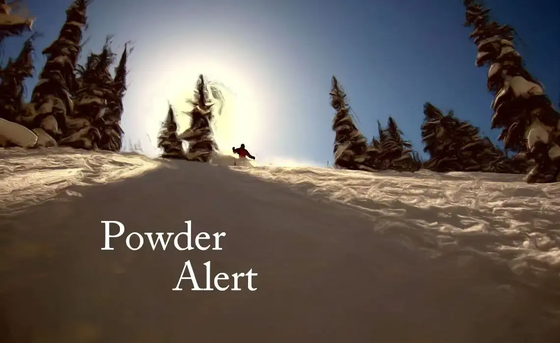
And thanks very much, Andrea, for helping us out here. That picture to the left is in the South Back at Crystal a couple of years ago. I've got a good line there.
Quick mention of Hurricane Milton. You know, it's hitting Florida right now, just moved on shore in the last hour. And they're getting winds of 120 to 130 miles per hour, a big storm surge.
(1:30 - 1:38)
But it's a big weather story. So I just thought I'd mention it. A lot of you out there are weather fans and it's a huge, huge hurricane.
(1:38 - 2:24)
They're having a storm surge. And the reason we will never have a hurricane up here is one solid reason. The water temperatures are too cold.
You need 80 degree water temperature. And you need it over a large ocean area the size of the Gulf of Mexico or certainly the Atlantic or down toward south of Hawaii. There's a huge area of 80 plus water temperature.
So we're never going to have one up here. We have other wind storms, though, but we're not going to ever have a hurricane. All right.
Let's move back to the Northwest forecast short term. I don't expect any issues or I should say any snow in the next week or so. We've got some high pressure moving in and out and then some weak storms mainly going to the north of us, just brushing us.
(2:24 - 2:49)
So we could get a few sprinkles next week, but really for the next five to seven days, it's pretty much a dry forecast. But typically it's mid to late October when the atmosphere starts to feel fall and winter. So I think not only is that a good sign, but also there's a sign on the models that there might be a storm cycle with mountain snow the second half of October.
(2:49 - 3:00)
Now, it's very unusual to get much snow in October, but at least it's a start. And what I'm really seeing positive is we don't see any blocking high pressure. Things are kind of moving along the Gulf of Alaska.
(3:00 - 3:06)
We have some rain over the weekend, that sort of thing. So we don't have any nasty blocking patterns. So that's good.
(3:06 - 3:16)
We don't expect any in the La Nina. Yeah, we did have some snow last Saturday. Not only I saw some on the crystal cam, but here on the left was the roundhouse at Whistler.
(3:16 - 3:24)
But you can see today it was pretty much melted. And that's sort of the case in October. We do get a little snow from time to time, but it melts out pretty quick, even in the higher elevations.
(3:24 - 3:40)
Maybe a few of the gullies above 7,000 feet or shady spots might stick with the snow, but it doesn't last very long. This is very typical. And we'll start off with just kind of a quick review of why we even have weather.
(3:40 - 4:07)
Well, the reason is the sun heats the earth differently from the poles to the equator. And this contrast of air between the cold north and the warm south does not occur gradually. If you took a boat, let's say, from the tropics all the way to the North Pole, it happens very much in these very narrow bands that separates the coldest air from the warmest air.
(4:07 - 4:19)
And those are called these Rossby waves. They're waves that undulate around the cold air moving into the warm air, and that's where weather happens. So when we can forecast those waves is when we can forecast the weather.
(4:20 - 4:33)
When we get, like in this picture, a big ridge off BC coast in Alaska, that means fair weather. As you see in this picture, the cold air is pushing over Montana. That means cold and unsteady weather.
(4:33 - 4:50)
So it moves in these slow-moving waves, and these are what cause our storm cycles. That's why sometimes it'll snow off and on, sometimes heavily, for a few days to a week or 10 days, and then sometimes it won't. It's moving these troughs and ridges along the way.
(4:51 - 5:01)
And you can see another example of it here. The jet stream or the stormy icon is there. The jet stream steers the storm, but it also develops storms.
(5:02 - 5:19)
And it isn't a continuous high stream of air about 30,000 to 40,000 feet, but it moves in little bands around the Earth. And you can see it outlines some of those curvy bulges going up and down, bringing cold air down or warm air up. All right, that's the lesson for today.
(5:20 - 5:26)
Let's get back into the forecast. Last year was an El Nino. Oh, all storms must bow to El Nino.
(5:26 - 5:39)
Remember this bit, El Nino? This was Chris Farley in Saturday Night Live many years ago. And El Nino does not favor our snow. And last year we had near to below snow levels and snowfall.
(5:40 - 5:50)
And the snow levels kind of varied a little bit, but the snowfall was really below normal in many spots. So it wasn't a banner year by any means. There were good days, no question.
(5:50 - 5:59)
Just shows you we can have good days in El Nino. You've got to just cherry pick them. But it's not El Nino like last year, which doesn't tend to favor.
(5:59 - 6:10)
This year it's La Nina. And so we can expect near to above normal snow. And in many cases we do have a near normal or even earlier than normal start.
(6:11 - 6:22)
Whistler already said they're going to open up the 22nd. And there's several other areas that are going to open up about that early too, about Thanksgiving Day. And a lot of it has to do with snowmaking.
(6:22 - 6:32)
But, you know, we can still get some really good storms in November. You know, November is our wettest month. And it can be our snowiest months up there or one of the snowiest months.
(6:32 - 6:41)
But the snow levels does fluctuate a lot in November. So we'll have to watch that. Seasonal snowfall forecasting is a tough animal.
(6:41 - 6:56)
The seasonal forecasts are not very good. And they're mainly driven by this El Nino or La Nina phenomenon, which I'll explain a little bit more about later. But the exception is La Nina for the northwest does have a pretty good correlation.
(6:57 - 7:21)
It's not perfect, but I think it's better than most other areas and most other phases of El Nino or La Nina. And remember the snowfall happens in these storm cycles. And don't get depressed if you have a few weeks with inconsistent snow, because one month or a couple-week period does not necessarily telegraph what's going to happen in the subsequent week or two.
(7:21 - 7:28)
So you don't really get stuck in patterns too often. They do eventually change. But it also cuts both ways.
(7:28 - 7:43)
If we have a really snowy couple weeks or month, it doesn't mean the rest of the winter is going to be like that either. So just watch for those really great days. La Nina does bring below normal temperatures and abundant snow.
(7:43 - 7:52)
So the quality of snow would tend to be good. It doesn't mean we're not going to have some warm storms. It's just more often than not, we're going to have some pretty good storms.
(7:52 - 8:03)
That was a pretty good day, that picture. Here's a couple examples of La Nina years, 17, 18. And we had 90% of normal to 125% of normal snowpack.
(8:03 - 8:14)
That's in the Cascades of Washington for the most part. And 2019 and 20, that La Nina produced above-normal snowfall for everyone. Now, here's one thing you've got to remember.
(8:14 - 8:32)
It doesn't fall evenly all season, start December, blah, blah, blah, and continues every month even. Some months will be better than others. But in the end, in the end is typically they measure it April 1st is what the end date is for snowpack measurement.
(8:32 - 8:41)
And that's where we get these figures from. That's what they target for. But, you know, it does vary on how often or how much it comes in.
(8:41 - 8:54)
Above normal confidence, it does give us more confidence when we have a La Nina that we'll have a good pattern. And you can see in this pattern here, we have a polar jet stream that brings some cold air. And then we have this Pacific jet stream that brings the wet air.
(8:54 - 9:10)
And so we're right in the cross section of these where it really creates good snow with moderate to low snow levels and also moisture constantly feeding in. So it's a good pattern for us. Not as good for the southwest and the southeastern part of the country.
(9:10 - 9:21)
Not much skiing in the southeast anyway. But those areas in New Mexico and southern Colorado that did pretty well last year will not do as well this year. Here's the official forecast.
(9:22 - 9:30)
It's no surprise. It's exactly what we expect it to look like with a La Nina pattern. And that is above normal precipitation all the way in through northern Idaho.
(9:30 - 9:42)
So, you know, silver and 49 degrees north. Those guys will get above normal snowpack. But so will we in the Cascades of Washington and Oregon.
(9:42 - 9:53)
And it will kind of get close to Sun Valley there. Brundage will do good. And the below normal temperature on the right side will help us keep the snow in good shape.
(9:53 - 10:07)
Now, remember, this is just the general look over a three-month period. It kind of aims right at the middle part of the winter, December, January, and February. And so it could be weighted better earlier or later.
(10:07 - 10:17)
It doesn't mean it's even all year round. And it doesn't exclude warm storms either. It does show also down through the southwest, you know, sort of a drier pattern.
(10:18 - 10:29)
Through California, like the Tahoe areas, it says equal chances for both the temperature. So Tahoe, a lot of people think La Nina and El Nino relate well to Tahoe. It does not have a good correlation.
(10:29 - 10:41)
People think it does, but it doesn't. And so they're going for equal chances, which means 50-50 that it will be bad. Not bad, but not as much snow or, you know, more snow.
(10:41 - 10:53)
So a couple of years ago, they had a La Nina where they had an incredible snow year. So it does – there are exceptions is what I'm saying. Okay, a couple things you could do for your planning.
(10:53 - 11:03)
You know, look for areas that have an early good snow base. And that will be a combination of natural snow and snowmaking. Don't underestimate snowmaking.
(11:03 - 11:17)
It can really fill in the gaps in some areas like Crystal and Whistler I've seen it fill in. Of course, Sun Valley is famous for it. If you're thinking about early ski vacation, you know, I would advise don't book anything until you see snow on the ground.
(11:18 - 11:34)
I think the only exceptions to that are Whistler, Grand Targhee, and Sun Valley, who has extensive snowmaking. But Whistler, and especially Grand Targhee, has really high-quality early-season snow, not every time, but a lot of the time. And watch the short-range forecast, less than five days.
(11:35 - 11:50)
If you have the flexibility, that's the best thing because you can see what's going on and the forecasts are pretty accurate in the three- to five-day range. Not so much in the long-range. Here's a couple of La Nina impacts for December through February.
(11:51 - 12:02)
You can see in the northwest this cool and wet pattern, dry and warm down through the southeast. Australia gets some really wet weather during La Nina. They've had bad floods down there.
(12:02 - 12:12)
Remember, it's the southern hemisphere, so they're experiencing summertime. They have really rough weather down there sometimes during La Ninas. And it's kind of mixed along the Asian coast.
(12:12 - 12:18)
I know a lot of people want to go to Japan. I think it's favorable in Japan. They're cool and snowy.
(12:19 - 12:31)
The cool, dry air comes right off the Asian continent, sucks up moisture over the Sea of Japan, just dumps it over northern Japan. That's especially good in January, early February. I want to note, too, look at Europe.
(12:32 - 12:53)
There's no La Nina or El Nino signal there, so that just doesn't cut it. So just be aware of that, and they can have good and bad. La Nina and El Nino don't affect every place, and they don't affect every place all year round.
(12:53 - 13:08)
The most areas affected are down through parts of, well, western continent of North America and then down through the tropics here, because it really occurs down there. I'll show you in just a second how it works. So here's how it's evolving.
(13:08 - 13:20)
Here's how we look at it. The blue here is cooler than normal temperatures. So there was a real red area last year that showed El Nino, but now it's cooled off significantly.
(13:20 - 13:42)
What happens is down through the tropics here, the water kind of sloshes back and forth along two- to seven-year cycles. And so it sloshed really to the right toward South America last year with El Nino, but now it's starting to slosh the other way. So it only goes for so long a time.
(13:42 - 13:51)
And that's what determines whether or not it's an El Nino or La Nina. When it's cooled down here, it's La Nina. When it's warm, it's El Nino.
(13:51 - 14:06)
And you say, well, what does that matter? What's going on down there? We live way up to the north here. Well, guess what? It's kind of a magical thing. Down in the tropics, the thunderstorms get fired up by this very warm air.
(14:06 - 14:22)
If it's warmer than normal, you get more thunderstorms persistently down here. And so what that does is make the air rise in these big clusters of thunderstorms, and that perturbs or sort of disturbs the upper atmosphere. And think of it like when you throw a pebble into a pond.
(14:22 - 14:46)
There's those little waves that move out. Well, it happens in the atmosphere, except it's on a much bigger scale. Those thunderstorms in the tropics create these waves in the upper atmosphere that telegraph a pattern to the jet stream, which the jet stream occurs up and through here, and it makes it sort of bend in different ways that's favored or disfavors us.
(14:46 - 14:56)
That's how it works with El Nino and La. It's not a perfect match, but that's the explanation. So a lot of people ask what models to use and how do you use them.
(14:57 - 15:12)
These ensemble models are the best thing to use. The short-term 12 to 72 hours are excellent for the GFS, which is the U.S. model and the European. Longer range, European tends to be better, but the best ones are these ensemble ones.
(15:12 - 15:37)
And what the ensemble is, it takes a point like right here, and it says it runs many different models. And if you perturb them a little bit at the beginning, what they do is they kind of stick together for a while, and then they start to, as time goes on, they start to move in kind of a fan. And so you get this limits of how warm or cold it might be.
(15:37 - 15:50)
And you want to kind of follow the middle of it. But sometimes I've seen it on one side or the other, this sort of general area. That's how we forecast the weather these days, using these ensemble techniques.
(15:50 - 16:02)
In the short term, if you want to look it up, there's an HRRR model. It's a rapid refresh, it's called. And this updates every hour, but it only goes out to 18 hours.
(16:02 - 16:13)
But that might be really helpful if you want to look like I'm going skiing tomorrow at Stevens or Crystal or the Pass. It will show you an update really quickly. But I don't have time to kind of sort through that one.
(16:13 - 16:27)
But that is another model that's very helpful for skiers, if you have the flexibility to go to a second's notice. Here's another look at the El Nino La Nina. And you can see the water sloshing to the left.
(16:28 - 16:33)
The red is warm for La Nina. El Nino sloshes to the right. The winds change direction.
(16:34 - 16:38)
The pressure changes. This is another look at it. So this is what's happening now.
(16:39 - 16:47)
It's all going to the left, the warm water. To the right, you get the cooler water. So that's how we're working.
(16:49 - 17:03)
These 14-day forecasts beyond 14 days, two months, or the whole season, they're mainly driven by this El Nino La Nina or neutral pattern. Neutral is in between. Technically right now we are neutral, but we're heading toward La Ninas.
(17:04 - 17:09)
It's very close. We're almost there. Also some recent weather trends using some models.
(17:09 - 17:20)
That's how they make these forecasts. And sort of this 10-year average, if the average in the last 10 years has been warmer than normal, so they play that into it as well. So those are some of the things.
(17:20 - 17:30)
It's very – you have to really squint your eyes sometimes on these. They're not that great. And they really don't give you too much information as far as your weekly, what day or week you're going to be there.
(17:31 - 17:43)
But they give you kind of a general idea that this will probably be a good winter, a good winter by a season pass. This is how El Nino and La Nina go back and forth over the years. The blue is La Nina.
(17:44 - 17:57)
The orange is El Nino. The big one here is 98-99, especially 98-99. This is when Mount Baker had the 1,140 inches of snow during La Nina.
(17:58 - 18:07)
So La Ninas really do help us out here in the northwest. This is another part of the forecast. And I like this little dial thing.
(18:07 - 18:15)
This is from the Australian Meteorological Agency. And it's a little dial. And it's still in this neutral zone, but it's headed to the left.
(18:15 - 18:27)
And it's going to end up somewhere in this light blue here, probably around right where my cursor is. To give you an idea, last year, it was El Nino. It was in the orange here.
(18:27 - 18:37)
It was actually 2.0, so it was right about here. So we've watched it slowly cool off. It's now in neutral, but it's still headed to the left.
(18:37 - 18:47)
I think the next report that comes out in the next couple weeks will get it in this low part of La Nina. So that's how it works. And this graph here shows what the forecast is.
(18:47 - 18:54)
The blue is La Nina. You can see we're in August, September, October. So we're sort of in this October period.
(18:54 - 19:04)
We're just transitioning to the blue, which is La Nina. But you can see it really strong right through December, January. And then it starts to taper off.
(19:04 - 19:20)
And it looks like neutral kind of sets in by late in the season. But the snow will be there by then, so don't worry about it. It seems to have its best focus like late December through kind of late February, early March.
(19:21 - 19:41)
So that big year, remember that big year I was mentioning about Mt. Baker, 98, 99? They had the most snow in February of that year. It was kind of an average or kind of a decent average year, Mt.
Baker. It's February where it really turned on. They had almost 10 to 12 inches almost every day.
(19:41 - 19:52)
It was unbelievable. Here's a look at a powder storm. You want to see that the storm curls up here like a big cinnamon roll.
(19:53 - 20:08)
And this part of it is kind of warm and wet and moist and kind of high snows, maybe 4,000 to 6,000. This is the best part of it right here. When this whole thing moves to the right and you get this pattern right here, this is cold and unstable air.
(20:08 - 20:20)
It could just dump snow. This is typically the part of the storm that the convergence zone develops into. So you get cold and really low snow levels and excellent quality snow.
(20:20 - 20:36)
That to me is when I see a storm that looks like this, I look for where is this headed. This is the sweet spot. Now you can get a lot of snow in the wet and milder spot, depending on what the profile of the temperature is.
(20:36 - 20:40)
But that sweet spot is good. Okay. But there are some exceptions sometimes.
(20:41 - 20:52)
To the left you can see a Pineapple Express pattern. It moves from north of Hawaii and goes into California in this case. So we want to look at the Hawaiian Express warmth.
(20:52 - 21:01)
It's always lurking out there. We do get these storms every year. And they come from near Hawaii, but sometimes they come in other directions.
(21:01 - 21:25)
But they're warm and they produce high snow levels, and they give us fits sometimes. Sometimes, though, I've seen them come in, and if you get a little north of them, they can be okay. Pineapple Express is not a stoner comedy starring Seth Rogen, and it's not a train ride near Honolulu costing $13.75. But that train ride looks a lot of fun anyway.
(21:26 - 21:34)
But what it is is – I wonder if we can play this video. This is a video I produced. I'm going to give it a try.
(21:34 - 21:46)
I hope this doesn't crash the whole program. But this is a one-minute video that I wrote and produced for Scripps Institution of Oceanography about what is an atmospheric river. And in just one minute, if you just have one minute, it'll explain the whole thing.
(21:46 - 21:53)
Okay, you ready? Put on your seat belts. Here we go. One minute on.
(21:55 - 22:10)
Imagine a river in the sky with more than twice the water of the Amazon. It's called an atmospheric river. Atmospheric rivers are long, narrow bands of concentrated water vapor that produce major amounts of rainfall.
(22:11 - 22:34)
Atmospheric rivers begin in the warm waters of the Pacific, where water evaporates into the air. When this humid air meets a Pacific storm, the water vapor is concentrated and driven toward the coast, becoming a firehouse of rainfall and wind. Once the atmospheric river reaches the coastal mountains and the inland Sierra, the collision squeezes additional rain and snow from the system.
(22:35 - 22:59)
Atmospheric rivers are responsible for up to half of California's annual precipitation. Scientists at Scripps Institution of Oceanography have developed a new system that rates atmospheric rivers on a scale from one to five. The rating system helps identify atmospheric rivers that are beneficial, such as those that replenish reservoirs and ones that produce hazards like flooding.
(23:00 - 23:22)
Understanding atmospheric rivers is key to improving weather forecasts for better managing water resources and predicting flood risk. I'd like to thank the Academy. I'd like to thank the Academy for the award of best video to explain something scientific.
(23:23 - 23:38)
Anyway, so here's a tip for atmospheric rivers. Now, if you get into the center or south of them, they're going to be warm, but if you can stay just to the north, they're often cold and they just dump snow. But it's a fine line.
(23:38 - 23:54)
I have seen these things come into Washington and hit like crystal and white paths with high snow levels and wet snow. And then if you were at Stevens, it was kind of a mixed bag, but better. But if you were at Baker, it was cold and it was dumping snow at 3,000 feet.
(23:54 - 24:07)
So sometimes you can thread the needle on these things. If you can just remember to the north of them is colder air. In the middle is this mixture of cold and warm, but to the south, it's generally warmer.
(24:07 - 24:12)
And they move around too. So you got to really time it right. But I've seen that happen.
(24:13 - 24:29)
Sometimes it creates, at the end, the snow level usually goes down and puts a coating of really nice, fresh snow. But sometimes it moves out without that colder air coming in and can create this mush or breakable crust. You can see I'm holding a piece of it there on the right.
(24:29 - 24:50)
And you can see on the top of the snow, those little valleys on the top of the snow, those are from the rain falling on the snowpack and it's draining off the top. So it can get pretty ugly sometimes. But a lot of times if you time it right, it can be primo and everybody's not going up because they think it's been raining.
(24:50 - 25:04)
But it gets to the last like few hours sometimes and it can dump several inches of really cold snow on top of the snowpack that is kind of chewed up a little bit. So watch for that. It can be a lot of fun on a Pineapple Express day.
(25:04 - 25:14)
I want to remind you to just be careful on the drive, you know. Give the guys working on the road, the DOT, a little extra room. Watch out for, you know, icy spots.
(25:14 - 25:23)
Be ready for anything. And then also on the trail, you know, watch what the ski patrol has kind of roped off. There's a reason they rope it off and stuff like that.
(25:23 - 25:31)
And there's plenty of room in bounds. Just have fun. We don't want to do any, don't want to have any problems with any of our users.
(25:31 - 25:35)
We have a good group here. So just have fun. Be careful.
(25:36 - 25:43)
So just kind of winding up a few things. We're going to have some brief warm stones of storms. That remains a possibility.
(25:44 - 26:00)
I remember La Nina doesn't rule. It only creates this favorable environment for storminess and cool storms will always be a good factor in the, in the winter time for the Northwest convergence. I want to mention that really quick.
(26:00 - 26:14)
It usually occurs after a front always occurs after a front. I should say usually favor Stevens in the summit, especially Alpenthal, but sometimes there could be multiple convergent zones. Up to Baker and one down at crystal.
(26:14 - 26:31)
Sometimes there could be one main one at Stevens in the summit, but it shifts especially toward the end of the day. And so be, be aware of that. So there can be multiple sort of versions of the convergence zone, but the main one typically happens from Everett to Stevens pass.
(26:31 - 27:01)
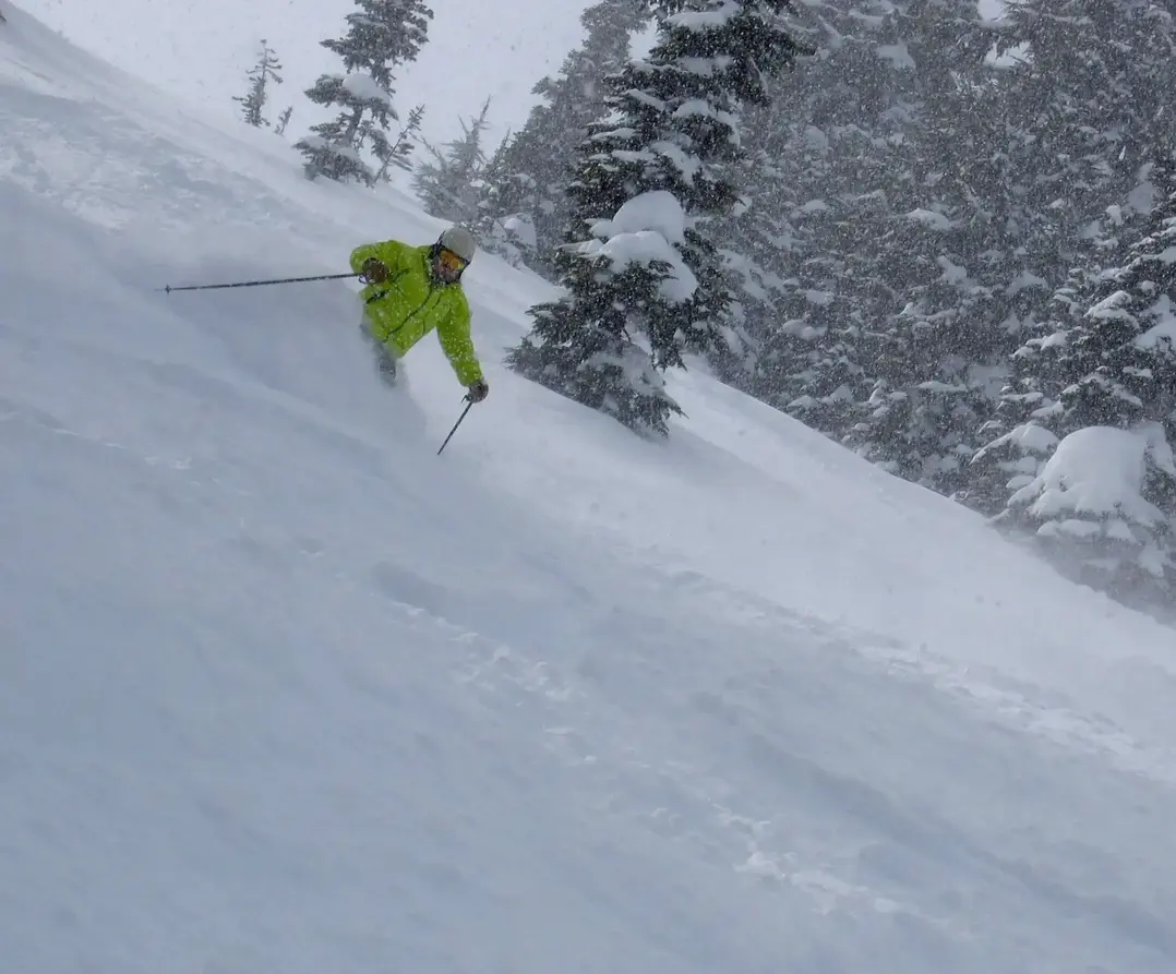
And this is what it can look like. That's me skiing in a convergent zone. It was, it was snowing one to three inches an hour.
It was unbelievable. And you know, if you've skied in these there, they can produce some excellent snow and always low snow levels for the convergence zone too. When you're sizing up the situation, you want to look at the resort and the cameras on the road, check the cameras lines, and see if those little dots on there are raindrops or snow frozen.
(27:01 - 27:06)
Look at the trees or the trees have snow. You know, it's snowed. The trees not have any snow on them.
(27:06 - 27:22)
Well, it's either wind or it rained on top of them, or maybe they didn't get that much snow. Look at the roads too. That'll, that'll tell you some deals.
So, you know, observe what you see on the cameras. You know, you can see a lot. A lot of people ask me what my favorite internet sites are.
(27:22 - 27:27)
Of course, Powder Puba, National Weather Service has excellent ones. Check their updates. They're very consistent.
(27:28 - 27:34)
Avalanche Center is great in Seattle. They have good forecast and snow data. Weather Channel has some good ones.
(27:34 - 27:50)
Some of my favorite blogs are Cliff Mass's blog for Northwest weather and Weather West down in California has a good blog too. Mainly California oriented, but it has some decent write-ups. Again, look for a good early season snow base.
(27:50 - 28:10)
If you're doing your ski vacation, be sure and check that out. Places early like Whistler and Targhee. It favors this late December.
La Nina does late December through March. You know, mid to late season is always better because the snowpack's been accumulating from the early part of the season. It's got the deepest snowpack and there's still good storms.
(28:10 - 28:18)
A couple things. It's not a snow guarantee, La Nina. I don't know how it will unfold.
(28:18 - 28:32)
Maybe the early part or later part of the season or middle part will be good. Warm Pineapple Express is always going to happen. I favor an early start.
Get well again is good. Don't mess around. If you hear it's good, one month doesn't remember.
(28:32 - 28:40)
So we'll see you in the snow. Expect above normal snow conditions. Certainly above normal confidence there will be good snow.
(28:41 - 28:49)
That's mainly what this does. It gives us higher confidence in the snow. Not necessarily the snow itself, but it gives us higher confidence that this will actually happen.
(28:50 - 28:56)
But we'll see you there. I just wanted to thank everybody for tuning in. We'll have some questions ahead.
(28:56 - 29:12)
We had a few earlier and I just wanted to bring it up. A couple questions we already had. What's reliable ways to contact Mt.
Baker for news that are three hours away like to know if they're delaying opening? I don't know. This is always a tough one. I don't know what to tell you.
(29:12 - 29:23)
Call them up or look at the Internet. That's really a tough call. They usually update it pretty early, most ski areas, but you're always taking a risk.
(29:24 - 29:32)
You never know exactly what's going to happen. Predictions for Japan. As I said, North Island does pretty good.
(29:33 - 29:44)
I would shoot for January, early February. That's the sweet spot with that snow there. I've never been over there, but I've heard great things, only great things about it.
(29:44 - 29:56)
There was one year that was a flop, but January seems to be the good target. That's all the questions and answers I have. But if you have more questions, and Andrea has more.
(29:56 - 30:08)
I do. Just for fun, my phone is sitting in front watching the video. We're watching with some people on Instagram Live.
(30:09 - 30:21)
Just for fun. Let's get to Dan right now. A couple of slides previous, you mentioned cold rain over snow, helping to preserve the snowpack.
(30:22 - 30:34)
Rain on snow. I think the question has to do with rain on snow. Is there an actual question or just a comment on the rain on snow? Sorry, his son wants to ask, does that also increase the avalanche risk? Okay.
(30:36 - 30:45)
Here's one of the things. When we have these Pineapple Express patterns, there's a couple of things that are going on. Sometimes they start off with a lot of snow, actually, because there's cold air in place over the mountains.
(30:46 - 31:02)
It starts this warm rain, but it's not warm enough to be rain yet. You get all this snow, and then the Pineapple Express scours out the really cold air, and it all becomes warm. You get rain on snow.
(31:02 - 31:13)
Yes, the Pineapple Express does create some very unstable snowpack. A couple of reasons. Anytime you have this great temperature change, that's a problem for the snowpack stability.
(31:13 - 31:26)
Number two is you get a lot of snow sometimes, either before or after the Pineapple Express or during it. So that's a problem, too. Both of those things, temperature and abundant snow, can be a problem.
(31:26 - 31:49)
I think there's probably more. In fact, I tried to do a correlation once on the Pineapple Express and avalanches. It's just really obvious that that's a connection, because snowpacks do not like, as far as avalanches are concerned, do not like temperature changes, very radical ones like that, especially when it warms up on top.
(31:49 - 31:55)
That's the problem. So, yeah, beware of that. You'll see that all the time.
(31:55 - 32:03)
The Avalanche Center, watch what they're doing. When that snow level rises, it can be problematic. So be careful.
(32:04 - 32:20)
All right. Okay, I have some other questions. What month do you anticipate the most snowfall during a La Nina year? The only months I would expect, I mean, it's targeted kind of late December through January and February.
(32:21 - 32:28)
Again, that Mount Baker one was all about February. I mean, you can't believe it. So that really targeted February.
(32:29 - 32:40)
But before that, it was snow and it was a decent season. It wasn't epic, but it was at or slightly above normal season. But it's really that February that turned out.
(32:40 - 32:54)
That doesn't mean every February. I would just say that's sort of the target I would be looking at, late December through kind of late February, early March right there. And that's the best part of the ski season anyway, I think.
(32:54 - 33:16)
For sure. Okay, why is there no La Nina or El Nino that impacts Europe? Yeah, so, okay, so there's several ways El Nino and La Nina affects things. Some are directly, like when I showed you that in Australia, it's like the warm water is right there off Australia.
(33:16 - 33:32)
So it's a part of the problem. The reality is it affects our storm track, and it's too far away kind of in a sense. So it doesn't connect with every place on Earth, just some places.
(33:33 - 33:40)
And so, no, it does not affect it. There's no if, ands, or buts about that. If you're hearing that, it's wrong.
(33:41 - 34:01)
But it's kind of like it's too far away to affect it. Okay, we have some people going to Europe this winter. Zermatt, St. Moritz in late February, and Chamonix and the Dolomites in February.
(34:03 - 34:04)
Yeah. Okay. Yeah.
(34:04 - 34:14)
Everybody always wants to know the forecast for their week. But, you know, we can't – I mean, I have to be honest. We can't forecast that, you know.
(34:14 - 34:24)
All I can tell you is – did you say it was February, March? Is that when that was? Yeah, late February, March. I mean, I went two years ago. It was fun.
(34:25 - 34:39)
We didn't have no snow, but it was fun. To me, that's the optimum time to go skiing because if you don't have snow by then, you're never going to have it, you know, or it's going to be pretty lame. So I would just – you know, I don't know what it's going to be like that week.
(34:39 - 34:44)
Nobody does. It's just not forecast. Anybody that says they know is lying to you, you know.
(34:44 - 34:57)
It's just not possible to forecast that. All I can tell you is that's a good time to go because you've got a really good, you know, part of the season behind you, and it should be a good base at least, you know. That's what we want to see.
(34:57 - 35:21)
Okay, cool. Someone sent in from the Google form, what are your suggested weather models for the Northwest and especially Crystal Mountain? Well, you know, I mean, as I said earlier, in the short – it all depends. You know, in the short term, if you're going beyond a few days, I would kind of lean a little bit toward the European model.
(35:21 - 35:29)
But everything else kind of comes together within two to three days. So, like, it all depends. I don't make a decision until a few days before.
(35:29 - 35:47)
And so all the models kind of come together right then. And so I'd use any model in the period of one to three days. And if you really want to – you're trying to think about the next tomorrow, let's say you were going skiing tomorrow at Baker, I would look at that HRR model.
(35:47 - 36:03)
That only forecasts, I think, 18 hours ahead of time, but it updates the forecast every hour. So it takes all the new data in every hour, the radar data and everything else. And so that's a really good model to, you know, do the real short term.
(36:03 - 36:16)
So it depends on your timeline of when you can make a decision. I mean, I make decisions sometimes last minute, but sometimes I do it 10 days in advance. If I'm doing 10 days in advance, I usually will follow the GFS model.
(36:16 - 36:44)
But I think the Euro's going to be a little bit better. Okay, just to let everyone know, hey, in the email follow-up when I get this posted, I will include the links to those references that Larry is talking about so you don't have to go hunt. Another question, the same person, is anyone, including you, Larry, able to give an overview of experiences skiing at Silverton Mountain in Colorado? Oh, yeah, so that's in southwest Colorado.
(36:45 - 36:53)
I know where it is. I haven't skied there, but it's a real high elevation. I've heard it's sort of – let's see what direction from Telluride.
(36:53 - 37:02)
I think it's just east of Telluride, near Silverton, Colorado, really high in the mountains. I've heard only good things about it. That's the only thing I can tell you.
(37:03 - 37:14)
I've never skied there, though, but I've heard excellent things about it. Okay, well, maybe we can look around. Let's see, someone else wants to know Mission Ridge prediction.
(37:14 - 37:23)
You talked about that last year, about some secret, some secret something. Secret something. Some secret way that you can see what's going to happen at Mission Ridge.
(37:24 - 38:03)
Oh, I know what I said. Okay, so Mission Ridge sometimes can have their best powder pattern is when a low-pressure area sort of goes sort of roughly where the Columbia River into Portland and then into eastern Washington and eastern Oregon. If a low kind of tracks in that direction, what it does, it does a wraparound, and the counterclockwise circulation bumps the air up against the east slopes of the Cascades, so you get actually in those conditions, you get the best snow at Mission from the east in that situation.
(38:04 - 38:18)
That's when you get your best powder days, in my opinion, at Mission because it's very cold snow. It bumps up against the east slopes. It just is fabulous.
(38:18 - 38:39)
The thing is that pattern doesn't happen very often, but you're looking for a low kind of tracking in that direction, kind of starting at the Columbia River mouth and tracking up the Columbia Gorge into eastern Washington, eastern Oregon. That'll create that wraparound moisture that I think favors Mission. Okay, another question.
(38:39 - 38:55)
How far south is the favorable pattern, Batchelor versus Tahoe? Yeah, really good question. It's really close to Batchelor. So, I mean, it favors Batchelor.
(38:56 - 39:15)
It does not favor Tahoe. But, again, that said, remember when we had a La Nina a couple years ago, Tahoe had fabulous snow, one of their best seasons ever. So just be aware that this stuff isn't written in stone.
(39:15 - 39:27)
There's a lot of variations to it. So that's fine-tuning it a little bit. But La Ninas really tend to treat us well in the northwest.
(39:27 - 39:51)
That's one thing that's consistent. Okay, Ella wants to know, how much do you consider elevation and which side the mountain faces for early season conditions? Yeah, so elevation matters, especially early season. Generally a rule of thumb I have is the farther north you are, obviously it's going to be cooler.
(39:51 - 40:14)
And the higher up you are, it's going to be cooler. So what does that mean? It means places like interior BC and Whistler tend to be better. In my book, I always add whatever our snow levels are here in Washington, like, for instance, up at the summit, subtract 1,000 feet and that's what you get at Whistler.
(40:14 - 40:18)
That's a rule of thumb. Sometimes it's a little more, sometimes it's less. But that's a rule of thumb.
(40:19 - 40:31)
And then the moisture, you have to have the moisture too. So I've seen sometimes, I think it happened last year quite a bit, that we got a lot of snow here in Washington and Whistler totally got skunked. It just went right by offshore.
(40:32 - 40:38)
So that can happen too. It doesn't necessarily always mean the storms move north to south. Sometimes they come right out of the west.
(40:39 - 40:49)
But that's the elevations that I kind of watch. The higher, the better, obviously, because it's colder. But that's early season too.
(40:49 - 41:06)
Once you get into the main part of the season, it can vary quite a bit. Was there a second part of that question? No, I think that. Well, and which side of the mountain faces for early season conditions? Well, eastern Washington tends to be better.
(41:07 - 41:36)
Obviously, north-facing parts of individual mountains in the early season and kind of middle of the season, even the late season, tend to keep the snow better because they're away from the sun. And so even in the afternoon when the sun breaks out, you don't lose as much snow from settling or from actual melt or evaporation or sublimation, what they call it. And so north-facing generally has the best snow everywhere in the northwest any time during the season.
(41:36 - 41:52)
Okay, thanks. Maureen wants to know, how does La Nina affect Colorado areas along I-70? Yeah, so let me see if I can get back to that one. Generally speaking, I'm going to try to get because I don't remember right off the top of my head.
(41:53 - 42:04)
I think Colorado, it's a mixed bag. There we go. So you can see kind of maybe northern Colorado, Steamboat or something might be more favorable.
(42:05 - 42:14)
It certainly plays up in Wyoming. Jackson Hole is going to be favorable. But you get to southern Colorado, and it's more in this dry, warm period.
(42:14 - 42:28)
Like Wolf Creek or Telluride won't be as favored. They are favored in El Nino much more than La Nina, southern Colorado. I think middle Colorado, like Vail and stuff, they're sort of a mixed bag.
(42:28 - 42:36)
As you get farther north, you get a little more favorable. So that's how I'd slice it. Wasatch and Utah, same idea.
(42:36 - 42:43)
Maybe a little farther north, a bit better. But in the central and south Utah, less favorable. Okay.
(42:45 - 42:59)
Ellen wants to know, hey, how do you compare Grand Targhee versus Jackson Hole for early season snow? That's a really good question. I've looked at that very closely because I like them both. They're both great mountains.
(42:59 - 43:08)
But I have to say the Grand Targhee does get the goods earlier. You know, they face the west. I think that's the key.
(43:08 - 43:25)
They face the west, and so they get some of the storms that are coming into us that we're favored by in La Nina. I think in my book, I think they're both great ski areas. I think Targhee does get better early season snow than Jackson.
(43:26 - 43:35)
But they both do okay, but Targhee is better. You always will see them opening up earlier, you know, with natural snow. I don't even know if they have snow making.
(43:35 - 43:40)
They probably do, but I don't know. Anyway, Targhee. I pick Targhee on that one.
(43:40 - 43:43)
Targhee. Okay. Oh, okay.
(43:44 - 43:59)
Galen wants to know about ski wax temperature. How does it matter? Any base prep tips from Kuba? I personally know that Larry takes his stuff to Sturdivant. I let Sturdivant handle it.
(43:59 - 44:03)
I don't want to ask too many questions. I don't really know, to tell you the truth. I don't know.
(44:03 - 44:23)
Andrea, do you know anything about waxing? You know, lucky me, I get to also work at Sturdivant, and my skis just go right into the shop. But I do actually carry, during the spring, I carry a rub-on wax. If I can, I carry it in my pocket, but I definitely have some different waxes that I keep in my car.
(44:24 - 44:37)
And the people in the shop will tell me which ones I need and when. So I rely on the shop people. Yeah, so do I. Same with boots and all that.
(44:37 - 44:46)
Shopping for the Sturdivant people. But, you know, we have some great shops in the area. But, yeah, whatever is convenient to get your stuff done.
(44:47 - 45:08)
And, you know, Larry was talking about be ready for when the snow falls. So if you have not gotten your skis tuned yet, don't wait until late November because they get slammed. And so the sooner the better, get your gear in, get your skis tuned, get your boots tuned, get your skis tuned, Because I don't think right now anyone's doing any promotion on discounts for tunes.
(45:08 - 45:20)
So don't, don't wait for that. Does anyone else have any questions? For Larry. Otherwise we'll wrap it up here and I just want to thank.
(45:21 - 45:34)
Andrea, of course, and everyone that showed up great questions. And we're going to try to do another one of these maybe early November when the storm track starts to get cooking. So we will do that too.
(45:34 - 45:50)
And, and don't expect much snow in the next week or two, but I think by mid to late October, we're going to start to see some action and usually, usually quite a bit of action. Okay. A couple announcements before you go.
(45:50 - 46:08)
Hi, everybody. This weekend, there's a swap over at mountain to sound in West Seattle. Ski swap.
You can also sell your stuff. The weekend of October. Friday, October 18 and 19.
(46:08 - 46:15)
I will, Larry will be. No, I will be at Snowvana, which is out at Montlake. Not Montlake.
(46:16 - 46:27)
What's it called? Out there. So we will be at Snowvana. It looks like it's going to be a really cool event.
(46:27 - 46:32)
They're going to do a swap gear for sale. New stuff. They've got films.
(46:32 - 46:38)
They're also still looking for volunteers. If anyone's interested. And then the week.
(46:38 - 46:49)
The following weekend, Saturday, October 26th. Is the women's outdoor connection event. This is something that is near and dear to my heart.
(46:49 - 47:04)
And without the help of powder Puba. Subscribers and some great friends and family. It's happening again.
And this is the third event. We're expecting about 200 people. We have 20 different outdoor groups.
(47:04 - 47:09)
And it's going to be really amazing. And then. That's it for announcements.
(47:10 - 47:23)
Galen wants to know what's the over under on skiing. What's the over under on skiing for Thanksgiving? I would bet on skiing for Thanksgiving. Somewhere.
(47:23 - 47:30)
It will be happening somewhere. Like Canada or maybe what? Who knows? Yeah, it could be Whistler. Could be crystal.
(47:30 - 47:39)
They do good job with snowmaking and natural snow. But I think in La Nina, I think everybody's going to be. Going to be doing okay.
(47:40 - 47:52)
Pretty close to Thanksgiving or. Maybe a week after, but some of the areas will be open. For Thanksgiving.
I have to admit. I've skied Whistler many early. Early Decembers and.
(47:52 - 47:56)
With snow. Real snow and snowmaking. They do a really good job.
(47:56 - 48:02)
They're getting a lot of the mountain open. You know, so. You can get skiing.
(48:02 - 48:06)
And sometimes interior BC can really shine. Too. So.
(48:06 - 48:11)
Okay. I'm okay. Lisa week.
(48:11 - 48:21)
I kind of covered Europe. It's a crystal ball. Is there any particular place in Europe that you'll be Lisa? And then Cammion wants to know what's your favorite snack.
(48:21 - 48:35)
What's your snow snack that you carry? Oh, wow. Good question. Mostly for anything from trader Joe's.
How about that? Okay, cool. Thanks Dan for getting on. Yeah.
(48:35 - 48:40)
Lisa. Larry, you want to give her a couple of sentences on. Forecast for Europe.
(48:40 - 48:52)
Yeah, just, just like I said. You know, I would go when you see snow on the ground, you know, Oh, I'll wait till at least February or March. There is no La Nina or El Nino.
(48:53 - 49:00)
Connection with Europe. It just doesn't happen. And so it's really difficult to have a seasonal forecast there.
(49:00 - 49:10)
You're just sort of 50, 50 odds. So go and enjoy, eat some food. Speak some different languages.
He have a good time. The views are wonderful. The food's great.
(49:11 - 49:30)
It's just a really fun place to be. It is. Okay.
I think we're going to wrap it up. And thank you everybody again for signing on and listening and opening up the emails. And thank you, Larry for thank you everyone.
Thanks, Andrea. Bye everyone. Okay.
Take care. Bye. Bye.
