Hello skiers,
Dont expect much new snowfall, but do expect more sunshine over the weekend.
A weak cold front will move through Washington on Thursday. That will mean mostly cloudy skies and a possible sunbreak. Expect a mix of a little light rain or light snow with the snow level at the mid slopes. Snow accumulation will be minor (trace-1).
Friday looks like a good day as high pressure builds in with a dry pattern and mostly sunny skies. There will be a chill in the morning air from the cold front which moved through Thursday but the sun will warm your face. Visibility will be good while you zoom the groomers.
The high pressure sticks with us through much of the weekend and that means generally dry weather. For your holiday weekend, the slopes will be busy with great snow conditions and plenty of sunshine for Saturday and Sunday. There will be some clouds at times, but no snow is expected. The groomers will be good, but youll have to share with a few other skiers.
Monday the high weakens a bit, allowing a few more clouds, sunbreaks and a minor chance of a brief snow/rain mix.
Next week looks mostly dry, with no significant storms
Larry Schick
meteorologist
The Grand Poobah of Powder
Convergence Zone a powder skiers dream
Something strange was going on. I just couldnt explain it. When I began forecasting in western Washington more than three decades ago on KING TV, there was a weather oddity I had never seen.
I could not figure out why there was so much extra cloudiness and rainfall between north Seattle and Everett at certain times. Much to my surprise I often observed a small but vigorous localized storm form after a weather front came through. Typically, there is a drying trend after a weather front.
I was puzzled by this non-textbook weather feature. As I investigated further, I finally found the answer. The mystery was solved for me by a recently published (1981) research paper by then unknown professor -- Dr. Cliff Mass (UW). The paper described our Puget Sound Convergence Zone -- what it is, how it forms and how to predict its formation. (Mass, C. F., 1981: Topographically forced convergence in western Washington State. Mon. Wea. Rev).
He found under certain conditions, air off the ocean moves around the Olympic Peninsula converges near Everett creating a small storm. Simple and brilliant. Puzzle solved and my forecasts improved thanks Cliff.
Dr Mass continues with unending curiosity about our unusual weather here in the NW. He understands the complex relationship of our topography and the adjacent Pacific Ocean. By the way check out Cliffs his new updated book: The Weather of the Pacific Northwest.
Our fascinating weather in the NW is caused by the arrangement of our stunning terrain and our proximity to the great Pacific Ocean. It is that arrangement which forms the Puget Sound Convergence Zone. The Northwest landscapes often direct or enhance storms, while the nearby ocean provides moisture and cool or mild temperatures to modify our local weather.
The convergence zone (CZ) is a bonus for skiers as it gives us an extra shot of moderate to heavy snow when the CZ starts cranking up. Its a Cascades snow machine. To powder lovers, its a parting gift after the main storm goes through. Also, since the CZ forms after the cold front, a CZ typically sees low snow levels with quality cold, dry snowfall - a skiers dream.
Heres how a convergence zone forms and what you should know for skiing it.
After a weather front marches through the region, the air behind often blows into western Washington from the west-northwest, off the ocean. As the air hits the Olympic Mountain range the airflow splits. Like a large boulder in a stream separates water. The northern airflow goes through the Strait, then breaks south toward Everett. The southern airflow breaks through the Chehalis gap toward Olympia and Tacoma, flowing north toward Seattle and eventually clashing with the incoming air from Everett. The two opposite arriving airflows converge near Everett causing the air to rise and cool that produces rain (occasionally with thunder / lightning & even snow) in the lowlands. But the mini weather system also extends east. That means big and quality snowfall within a narrow area in the Cascades.
The CZ tends to form Everett to the Cascades giving Stevens Pass & The Summit the goods. However, sometimes there are multiple convergence zones with one also forming near Mt Baker. Another bonus is CZ can migrate southward helping blanket Crystal and White. Convergence zones are fairly narrow (10-20 mi wide), maybe 50 miles long and cigar shaped west to east. They usually dont last much longer than a half day, but they can really cause the snow to pile up.
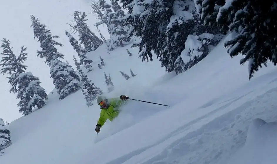
When a convergence zone forms and you ski it, expect a memorable powder day with free snowfall refills all day long. With a convergence zone the snowfall rate can be an amazing 1-2 an hour or more. Thats powderific! Dont forget your gogglesand your powder skis. Expect to float those powder turns and enjoy the innermost limits of pure fun.
