Hello Powder Alert Fans
- MONDAY: Sun breaks for the day
- TUESDAY: Breezy for the day; light snow showers late
- WEDNESDAY: Few snow showers early in the day
- THURSDAY: Dry
Keep reading for details.
Make sure you always check for road conditions:
Washington Department of Transportation
Hello Skiers & Boarders,
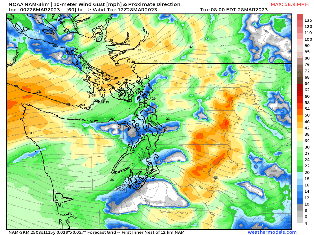
Starting later today, the main part of the storm track and snow will be to our south. With this pattern, we are expecting dry conditions with sun breaks on Monday. Tuesday, an area of low pressure will be off the Washington/Oregon coast bringing some gusty winds at times for the mid and upper slopes. The map below is for Tuesday morning, showing wind gusts of 40 mph (gold colors) at times. However, the good news is that, during the morning, we can expect some sun breaks. Then late in the day on Tuesday and into early Wednesday, some moisture moves in from the south to bring light snow (2 to 4 inches) by Wednesday morning for Crystal Mountain Resort, White Pass, and Mission Ridge. After the morning snow, the rest of Wednesday and Thursday will be dry.