


Featured photo. Powder runs from Brian Izdepski: Stevens Pass pic from Jan 10, 2024. "Big Fat Southern Cross kinda day. Not the lightest snow, but it was deep, and room for new tracks. A couple of top ten all time powder runs. Pegasus hadn’t been skied all year, so it was backcountry special…So smooth!"
Hello skiers and snowboarders,
This past Monday and Tuesday, many ski areas in the East and West Cascades and into 49 Degrees North and Silver Mountain received over 25 cumulative inches of snowfall. Some received over 33 inches. Much of the snowpack for the start of the year is just at 40% of normal. The map below shows some major improvement. As of yesterday, Central Cascades is at 83% of normal.

Short Term
Some additional new snow is expected today, perhaps up to 4 inches. Starting Friday and continuing through the weekend, we can have cold conditions and breezy at times. The good news is that we can enjoy all the fresh powder from earlier in the week. The other good news is that we can use our new gear to keep us warm. Friday's high temperatures at Snoqualmie Pass of 12 degrees F with winds at 20 mph at times means a wind chill of -6 at times. If there is any snowfall on Friday, it will be at Crystal Resort with just light snow.
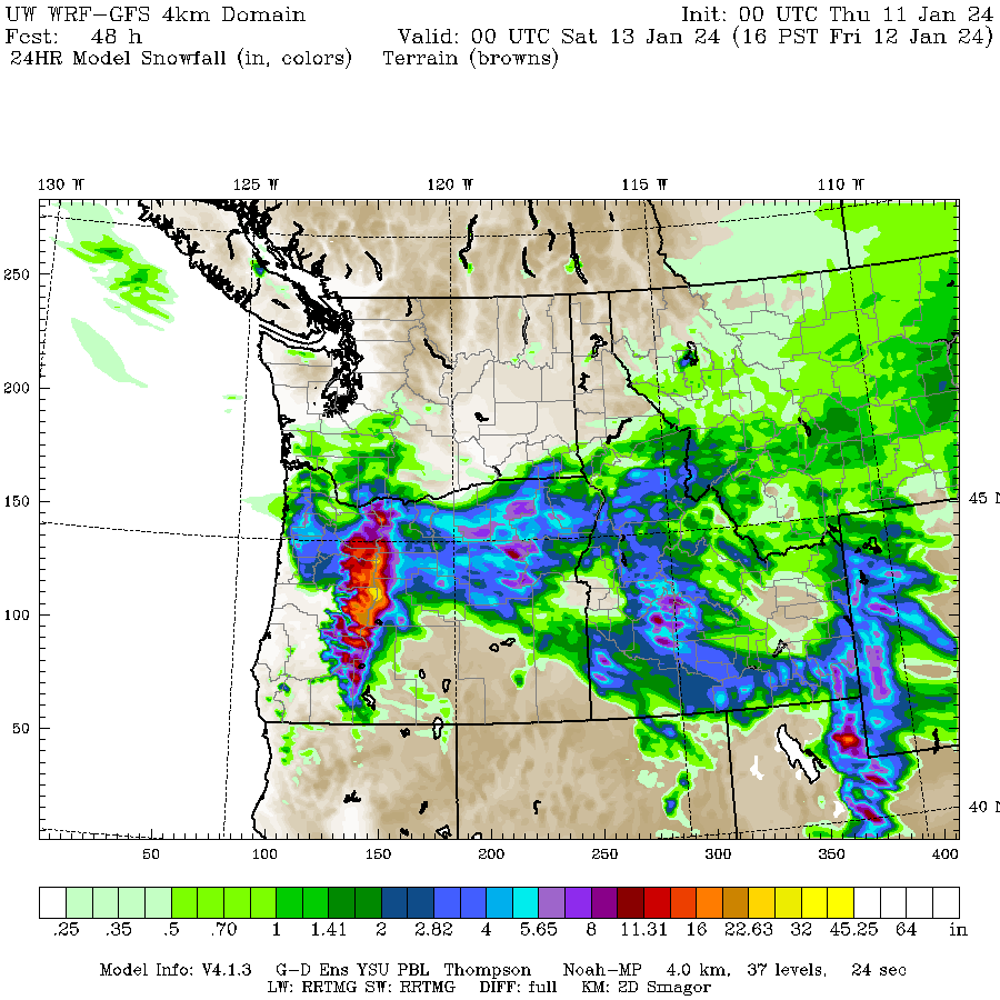
On Saturday, the main part of the storm track is aimed at Oregon (see maps below). We can expect dry and cold conditions with the high temperatures at Snoqualmie Pass of 7 degrees F and with winds at 20 mph at times which is a wind chill of -14 at times. Sunday and Monday conditions will continue to be dry and slightly warmer, with highs close to 20 at Snoqualmie Pass.
24 hour snowfall ending late Friday
24 hour snowfall ending late Saturday

Extended OutlookForecast models show some additional snowfall starting Tuesday and Wednesday of next week. There is disagreement concerning snow levels with some models suggesting an increase to 5000 to 6000 feet. At this point, I think there is too much uncertainty in the forecast. Make sure you check out our next update this Sunday. |
|
Meteorologist Michael Fagin. |


