Hello Powder Alert fans,
Who is ready to continue to enjoy some powder? Starting Monday, we can expect a trough of low pressure and an associated cold front to move into the region. Also, with this pattern, snow levels drop to 1000 to 2000 feet on Monday and Tuesday.
So, how much new snowfall from today through Wednesday morning? The map below has red and orange colors for much of the Western Washington Cascades. These colors represent 12 to 16 inches of cumulative snowfall from today through Wednesday morning.
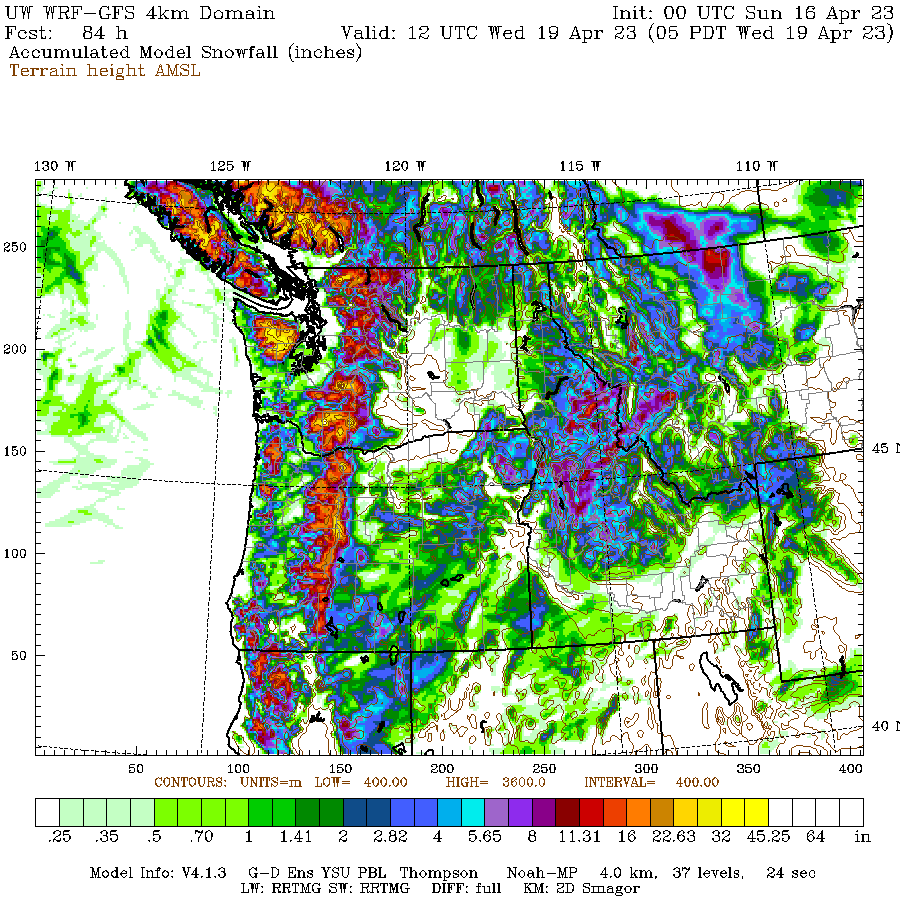
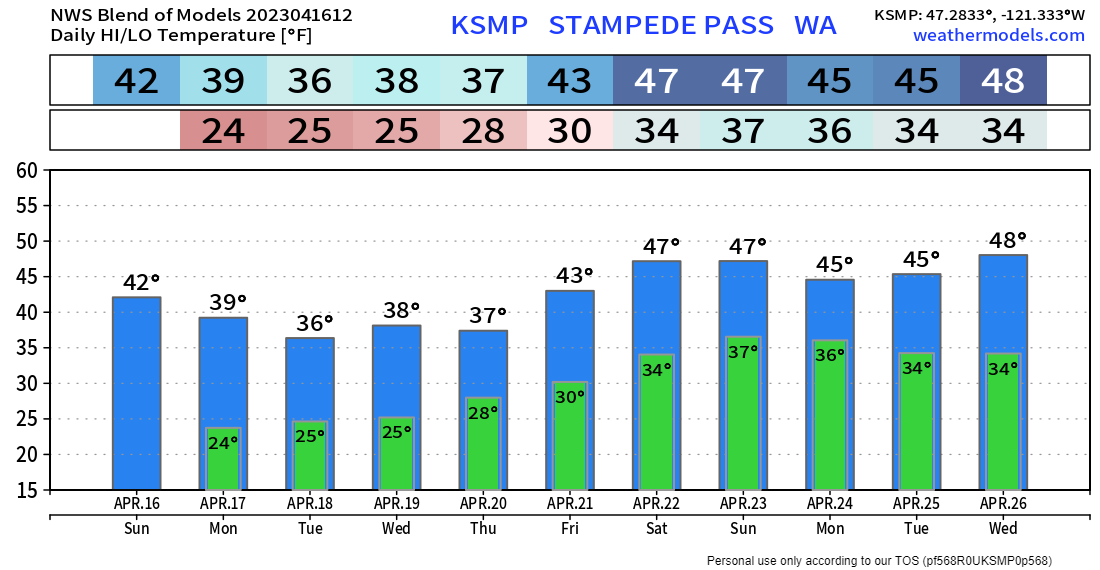
The graph lists the temperature for Stampede Pass (4000 feet). For Tuesday through Thursday, daytime temperatures will be on the cool side with highs in the mid-30s, so snow conditions should continue to be excellent.
So where will you be heading to get your powder turns?
Snowpack Update
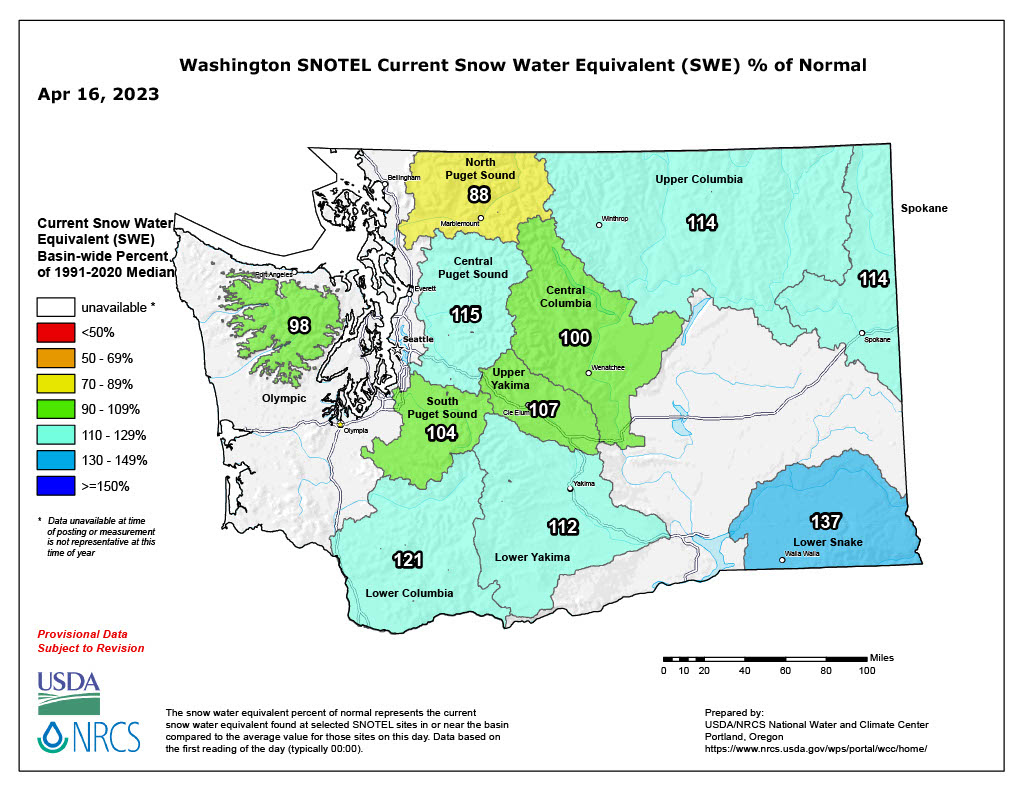
You can see from the map that Washington's snowpack has almost all regions above normal, 100 to 137% of normal. The Upper Columbia Basin is at 114% of normal, so that would cover 49° North and Silver Mountain. Thus you can enjoy their extended spring ski season.
This map is updated on 4-16-2023, and with the new snow coming this week, these numbers should increase. Here is a definition of Snow Water Equivalent (SWE).
FIELD NOTES from Andrea:
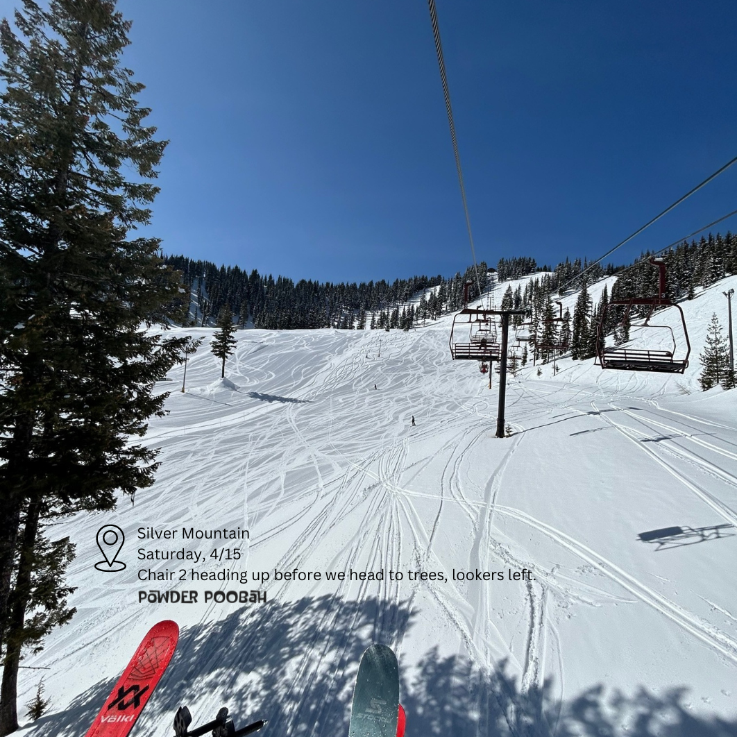
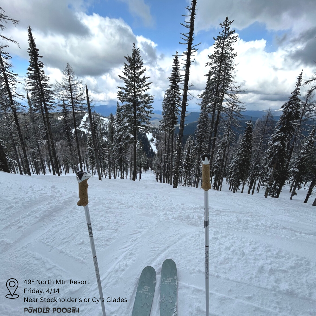
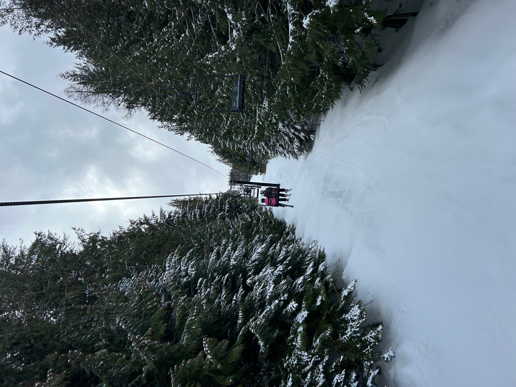
This weekend, I skied at 49° North in Chewelah, WA and Silver Mountain in Kellogg, Idaho. Fun runs, great groomers, and terrific tree runs. No crowds, great customer service, and also family-friendly. Go for their final days, or add these areas to your Powder Days calendar for 2023-24!
My son and I had a great time and plan to get east more often! I'll add more about these great areas when I get back to Western Wa.