|
Hello skiers and snowboarders,
Short term
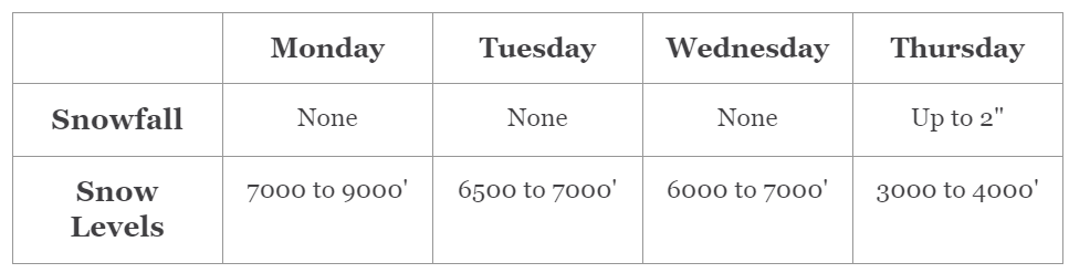
A mixed bag of weather is expected this week! We certainly have had our share of rain this weekend. On Monday the Cascades will get a brief drying trend with mild conditions and some sun breaks in the West Cascades. However, Mt Baker will get rain on Monday. Monday morning temperatures should remain above freezing.
The map below shows conditions at 4000 feet just east of Snoqualmie Pass. With these temperatures, the wet snow should not ice up in most areas.
On Tuesday it remains mild with rain at times and heaviest north of Stevens Pass. With this pattern, it will remain dry at White Pass and other areas east. Wednesday remains mild with rain over much of the region.
Cooler conditions return on Thursday with light snow of 1 to 2 inches at 3000 to 4000 slightly higher amounts above that.
|


