Powder Alert 01-15
- SUNDAY: Snow today with the best chance later today and tonight. Snow levels are at 3500 feet early then at 3000 feet for Sunday night. 3 to 5 inches of snow mainly for late in the day and into the evening.
- MONDAY: Snow with best chances early in the day and snow levels at 3000 feet with 2 to 4 inches of snow.
- TUESDAY: Much of the daytime will be dry. There will be chances of light snow early in the day, then late afternoon and evening. Snow levels at 2500 feet. New snow up to 2”.
- WEDNESDAY Snow levels at 2500 feet with a chance of snow of 2-4”. Although some models are much higher
An area of low pressure is to our south today and we can expect snow moving in from the south during the day. So Crystal Mountain Resort will get the snow first and then areas of snow will spread to the north for the afternoon and evening.
Snow levels will start at 3500 feet today then lower to 3000 for this evening and into Monday. We will have additional snow on Monday. So total snow for today and Monday will be in the 5 -7” range at 3500 feet with some snow at 3000 ft.
Tuesday will bring light snow perhaps 2” with levels at 2500 feet. However several models keep Tues dry. For Wed expect snow of 2-4 inches, keep a close watch on this, some models want to bring higher amounts.
The good news: snow levels stay low at 2500 ft so expect some goo fluffy snow at times.
Snowpack
The map shows snowpack is close to normal to slightly above normal. This is good news especially given the recent warm pattern and high snow levels. Let us not forget the recent Atmospheric River (AR) events that have occurred along the West Coast.
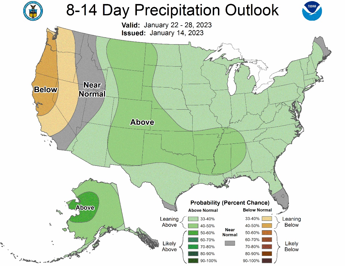
Extended 8 to 14 Day Outlook
The maps below show the outlook for 1-22-2023 to 1-28-2023 and show temperatures will be below normal with precipitation below normal. The good news any snow we get will be the type we like and not Cascade Concrete.