|

Hello skiers and snowboarders,
This is Meteorologist Michael Fagin, I will be handling much of the forecasting to enable the Grand Poobah of Powder to enjoy the snow that is on the way. Yes, the Grand Poobah will chime in with updates.
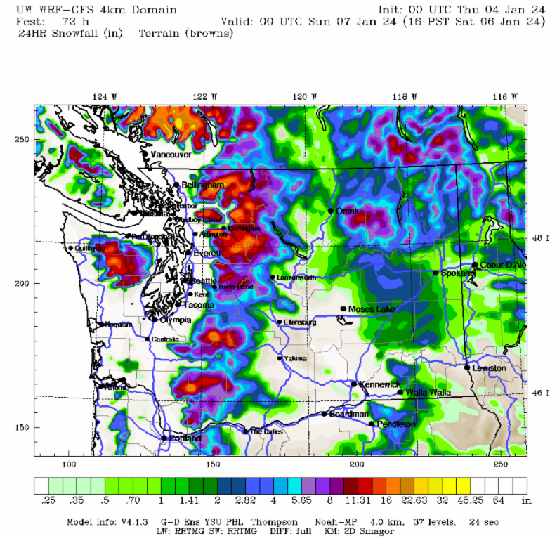
We will welcome the major weather pattern changes as we say goodbye to the warm conditions that we saw in December. Starting today and continuing through later Saturday, many areas in the West Cascades (see map below) will get between 12 to 16 inches of snow at 4000' with just slightly lower amounts at 3000'. The inland areas of 49 Degrees North and Silver Mountain will get 6 to 8 inches over this period.
We can expect the heaviest snowfall for the period of Friday afternoon to Saturday morning. Stevens Pass and Snoqualmie can expect up to 8 inches of snow during this period. Perhaps higher amounts if a Puget Sound Convergence Zone forms.
Then, for Saturday afternoon and into Sunday, we can expect to have light snowfall on and off.
Looking at this coming Monday, snow levels stay low at 1000 to 2000' with just light snow under 4 inches for Snoqualmie Pass and north. However, Crystal Mountain seems to be the winner for Monday, with up to 8 inches of new snowfall.
|
