Powder Alert 02-19
- SUNDAY: Windy with moderate snowfall for mid to upper slopes.
- MONDAY:Continued windy with moderate to heavy snow for mid to upper slopes, then snow levels drop to 3000 feet late in the day.
- TUESDAY: Windy early; snow levels near 200 feet late Tuesday night with additional snow.
- WEDNESDAY: A few showers early then some sun breaks and cool for the day.
Keep reading for details.
Make sure you always check:
Washington Department of Transportation
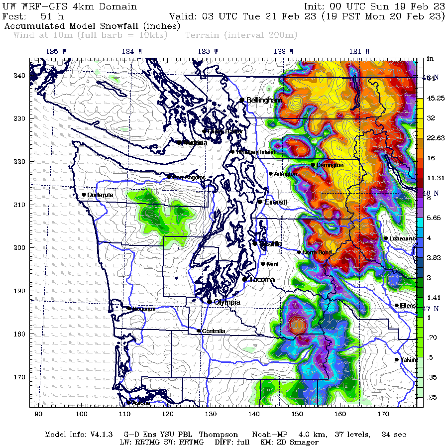
Today will bring moderate snowfall with the best chances of snow for the mid to upper slopes. Best to layer up for the strong winds on the higher slopes. During the day on Monday, snow levels drop to 3000 feet late in the day. So heavy snow for the mountains can be expected. The map below is the cumulative snowfall for the period ending Monday at 7 pm. Snoqualmie Pass and north will have snow in the range of 20 to 40 inches (yellow colors) for the mid and upper slopes.
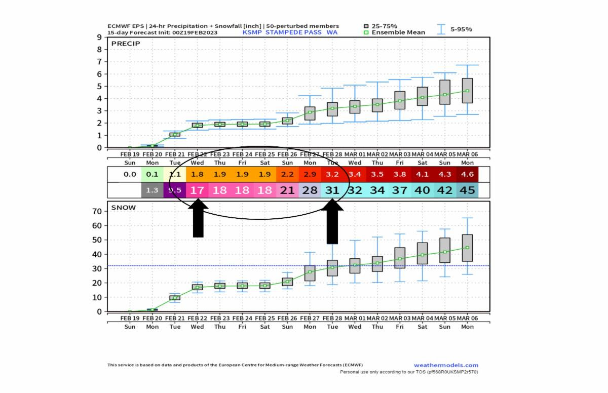
When is the best window to ski? With all the new snow coming, the tricky part is keeping the key passes open and the need for DOT avalanche control work. So always check the link below or call 511 for updates. Of course, a full tank of gas (or EV fully charged) with extra clothing is called for in case the pass closes.
Make sure you always check:
Washington Department of Transportation
Best weather window? Tuesday afternoon when we have slightly lower wind speeds and better visibility. Wednesday will be a great day, although cold.