Hello Powder Alert fans,
THURSDAY: we are expecting 5 to 7 inches of new snowfall; best chance late in the day.
FRIDAY: we are expecting another 5 to 7 inches of new snowfall.
SATURDAY: very light snow for much of the area; best chances are for Mt Baker and Whistler.
SUNDAY: just a trace of new snow, perhaps some sun breaks.
MONDAY: dry with some sun breaks.
Keep reading for details.
Make sure you always check:
Washington Department of Transportation
Road conditions will be changing often.
Hello Skiers,
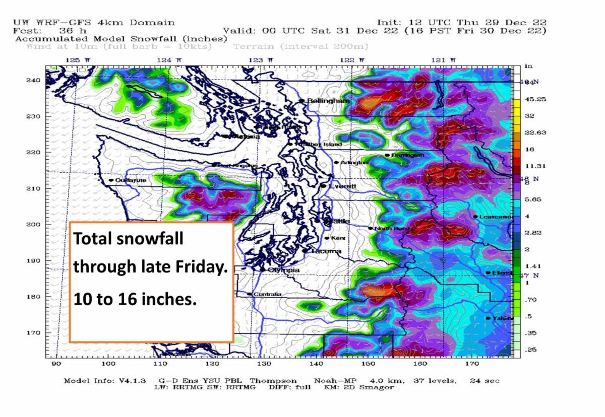
An area of low pressure will be moving through the Cascades during the next 24 to 36 hours. Thus we can expect some additional snowfall for the Washington West Cascades. Cumulative totals from today through late Friday are in the 10 to 16-inch range (see map below.) During the day on Friday, snow levels might briefly go up to 3500 feet.
Saturday, there will be snow levels at 2500 feet and just a chance of light snow showers, with the best chance of new snowfall for Mt. Baker and Whistler.
Sunday just a few snow showers and perhaps a few sun breaks. Finally, Monday will be dry with some sun breaks.
Ski Notes
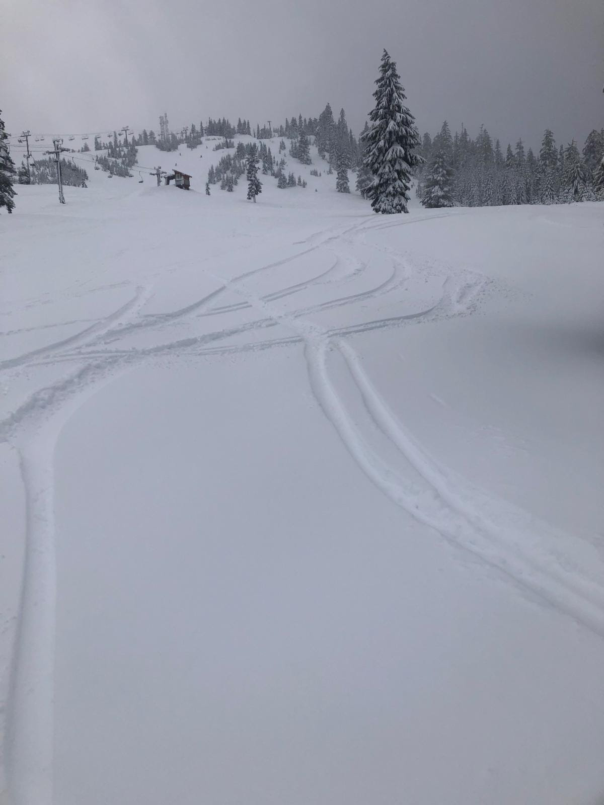
The photo below and ski report are from Sean Harvey, skiing Wednesday 12-28-22 at Summit West and Central/Silver Fir. "We’ve been rescued from the rain! Daytime temps were around 35 degrees and there was fine granule snow falling from time to time. While the conditions could not match a week ago (lots of new snow and temps in the high teens) there were about 4 to 5 inches of new, slightly wet snow, much of it ungroomed, especially at West if you knew where to look. The crossover between West and Central is open but not between Silver Fir and East. People were ducking under the rope but that route typically needs much more snow before the streams can be safely covered. Beware!"