Powder Alert 02-12
- SUNDAY: Increase in clouds for the day and a chance of a few light showers near Mt. Baker for the afternoon with snow levels at 5000 to 6000 feet. Levels drop in the evening with an increasing chance of snow late in the evening.
- MONDAY: Snow is heavy at times with snow levels at 1000 feet. Up to 10 inches+ by the end of the day. Windy at times.
- TUESDAY: Cool with a few snow showers early, then sun breaks for the afternoon.
- WEDNESDAY: Cool and dry with some sun breaks at times.
Keep Reading for more details.
Make sure you always check:
Washington Department of Transportation
Hello Skiers & Boarders,
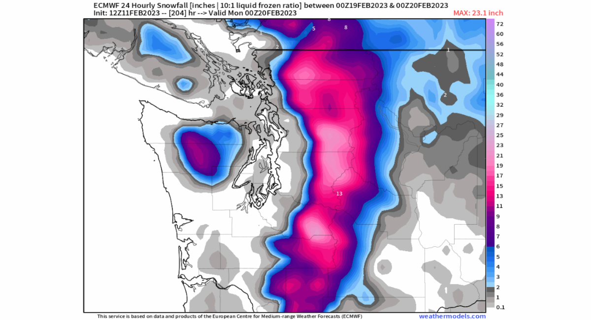
Starting Sunday and into Monday a strong trough of low pressure and associated cold front will move into the Cascades. Thus, we can expect heavy snow during the day on Monday, and with snow levels dropping to 1000 feet and perhaps lower, this will make for some great fluffy snow. Thus, one can enjoy powder this Monday with some limited visibility at times and much better visibility on Tuesday, with just light snow expected. The map below is snowfall for the 24 hours ending at 4 pm on Monday. Red colors are close to 10 inches and orange is close to 16 inches. On Monday we will have a Puget Sound Convergence Zone forming that will bring some intense snow at times from Stevens Pass to Snoqualmie Pass, so some areas might get up to 20 inches of snow from this storm.

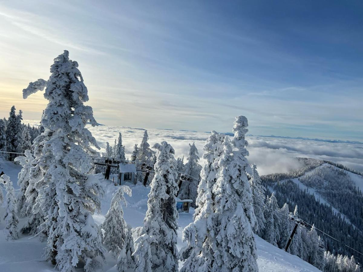
Chris and Carson enjoyed the views of Mt. Rainier, the skiing, and the sunny weather yesterday at Crystal Mountain Resort. Should be some great skiing with fresh powder this coming week.
Extended Outlook
For this Wednesday (see map below) we have a strong ridge of high pressure anchored over the West Coast to bring dry and cold conditions, so all the new snow from earlier in the week will remain great. Thus, dry and cool conditions for Wednesday and Thursday.
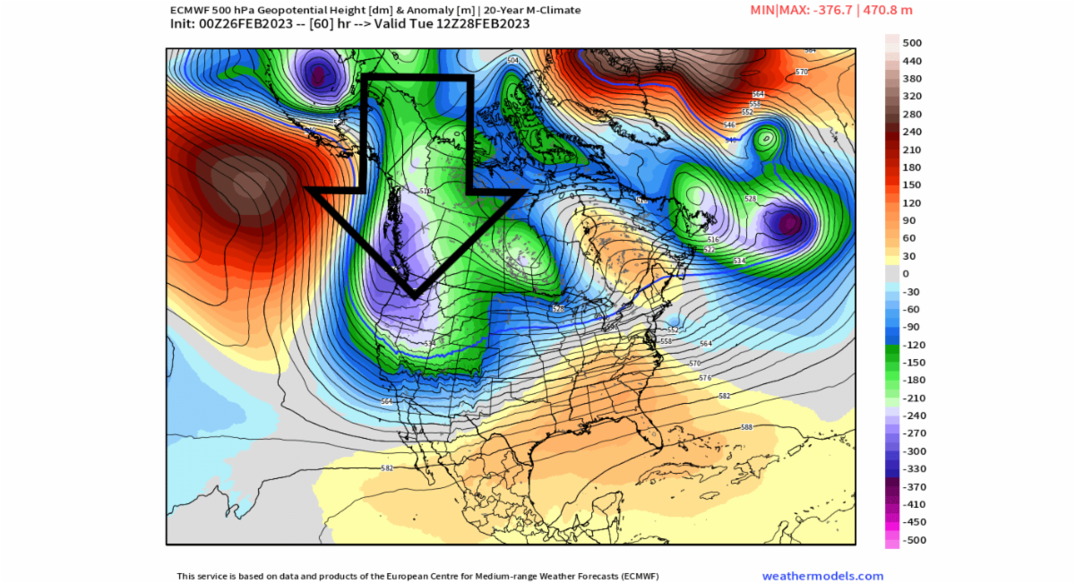
Next weekend more snow as another trough of low pressure and cold front move in. This is certainly an extended outlook but forecast models are consistent in bringing another 10 to 12 inches (red colors in the map below) of powder next weekend. This is snowfall for the 24 hours ending Sunday (2-19) at 4 pm. We will update you this Thursday.