


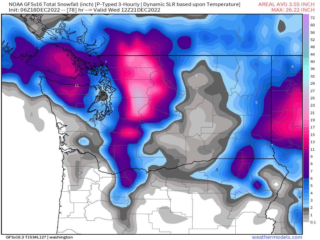
Today we can expect snow at 3000/4000 feet with new snowfall totals for the 24 hours ending Monday morning of 3 to 6 inches at 3500 feet for much of the Washington West Cascades. Cold air moves in for Monday and Tuesday with snow levels at 500 feet and lower at times. Thus, any new snowfall will be the type we all love - fluff. Monday should bring cool temperatures with just light snow showers, so great day to hit the slopes. Then some moderate snow (6 to 9 inches) on Tuesday. Cumulative new snowfall from today until Wednesday morning is 10 to 15 inches (red colors on the map below ) for Washington West Cascades.
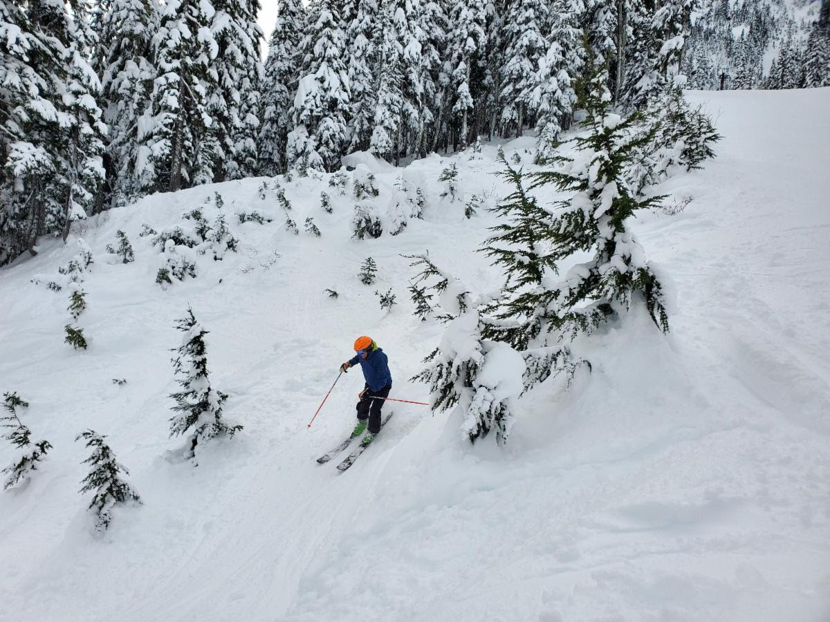
This week, Monday through Wednesday would be a great time to enjoy the slopes. The photo below is Greg skiing at Stevens Pass on the “Wall’s Street” run, a short black diamond run off the Hogsback lift from earlier this week. Photo credit Denis Dubois
Thursday we are looking at additional snowfall of 5+ inches and then a slow warming trend starting on Friday. What is the extended forecast for Christmas? Several forecast models bring a strong southerly flow with associated warmer temperatures moving in. The main message from the map below is that the arrows show winds blowing from the southwest, thus much warmer air to move in. The darker red indicates higher moisture levels. The bottom line is we might be looking at an atmospheric river (AR). The AR would bring moderate rain to the mountains. We will update you this Thursday 12-22. Note that this is the extended forecast so things can certainly change. Stay tuned!


