


Hello Powder Alert Fans,
- MONDAY: New snow of 4 to 8 inches
- TUESDAY: Clouds early, afternoon sun
- WEDNESDAY: Sunny and mild
- THURSDAY: Sunny and warmer
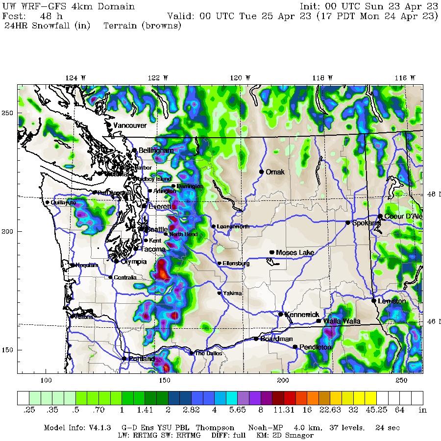
The rain that many areas are receiving this morning will turn to snow later today as snow levels drop. On Monday, snow levels drop to close to 3000 to 3500 feet. So lower slopes will get 3 to 4 inches of snow, and mid to upper slopes 4 to 8 inches of new snow. The map is snowfall for the 24 hours ending later Monday afternoon. Blue colors indicate 4 inches of snow and purple colors 8 inches.
Then starting Tuesday and continuing to Thursday, a ridge of high pressure starts to build at the surface and aloft to bring sunny and warming conditions.
Extended Outlook: Great Spring Skiing Conditions
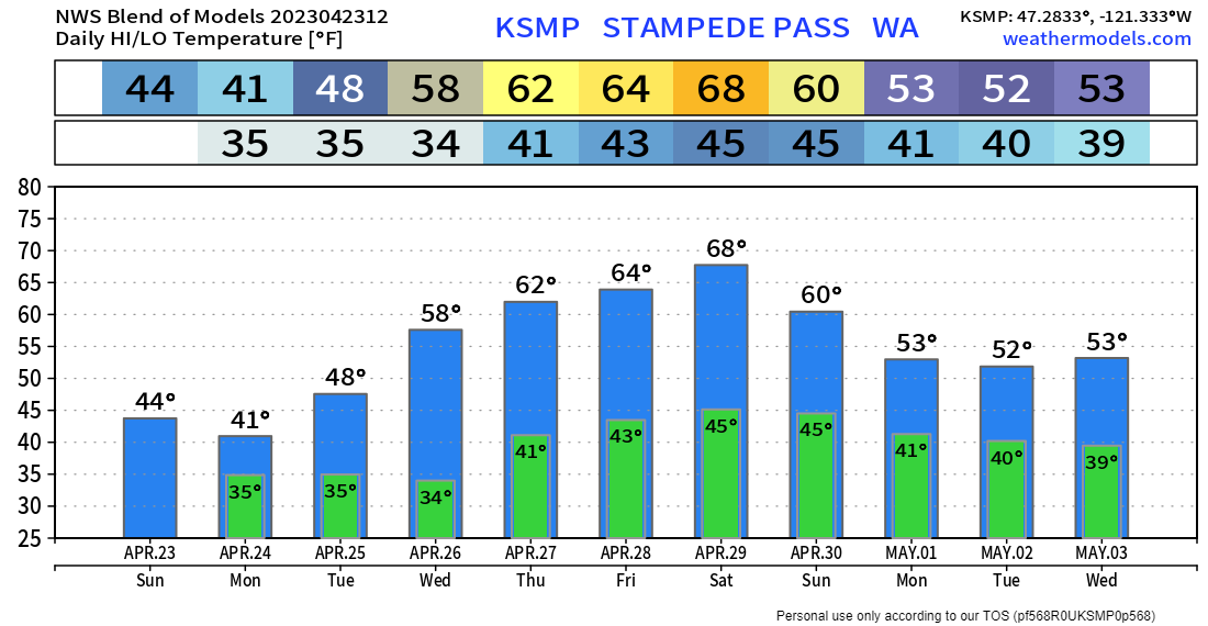
From Thursday to next Sunday, we are expecting sunny and mild weather. The bar chart is for Stampede Pass (at 4000'), indicating high temperatures in the mid to upper 60's.
This is a great time to get some spring turns in.
If you didn’t read the GPOP’S Season Recap last week, CLICK HERE TO READ THE DETAILS.
Support the Powder Alert. SUBSCRIBE HERE
Send to a friend for season wrap-ups and next season kick-off Powder Alerts.


